
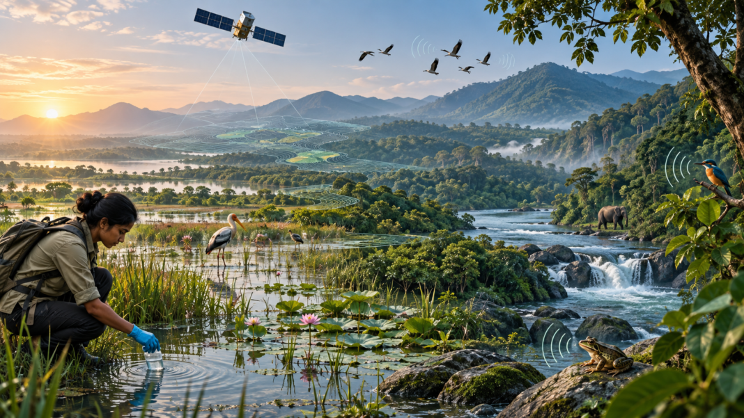

Biodiversity intelligence can now show a company where nature is changing before its annual review arrives. Yet a satellite cannot hear a forest fall silent. It cannot confirm which fish species remain in a river. Nor can it explain why a wetland still looks green while its ecological health declines.
That gap matters. Companies and financial institutions face growing pressure to understand how they depend on nature and how their activities affect it. However, biodiversity is local, complex, and hard to reduce to one number.
Artificial intelligence can help, but only as part of a layered monitoring system. The strongest approach combines Earth observation with environmental DNA, acoustic sensors, field surveys, and local knowledge. Together, these sources can turn scattered environmental observations into evidence that leaders can use.
Why biodiversity intelligence is harder to measure than carbon
Carbon accounting has one major advantage: greenhouse gases can be converted into a common unit. Biodiversity has no equivalent measure that works across every location and ecosystem.
A hectare of mangrove cannot be compared neatly with a hectare of grassland. Even two forests of similar size may differ sharply in species, ecological function, and resilience. As a result, a simple land-cover figure can hide important loss.
Location also changes the meaning of the data. Water use may pose little risk in one basin and severe risk in another. Likewise, clearing a small area beside a critical habitat may matter more than a larger change elsewhere.
The Taskforce on Nature-related Financial Disclosures addresses this issue through its LEAP approach. LEAP asks organizations to Locate their interface with nature, Evaluate dependencies and impacts, Assess risks and opportunities, and Prepare to respond and report.
However, that process needs detailed geographic evidence. Many organizations still lack accurate locations for suppliers, farms, facilities, and financed assets. Therefore, the first biodiversity problem is often a data problem.
How Earth observation creates biodiversity intelligence
Satellites provide a consistent view across large areas. Meanwhile, computer vision can classify land cover, detect change, and flag sites that need closer review.
This combination already supports several useful tasks:
- detecting forest loss and land conversion;
- tracking wetland extent and coastal change;
- monitoring restoration areas;
- identifying shifts in vegetation condition;
- screening supply chains for possible habitat pressure; and
- checking whether reported land-use claims match visible conditions.
Radar satellites add another advantage because they can observe through clouds and at night. India now has a major new source of such data. According to the Indian Space Research Organisation, the NASA-ISRO Synthetic Aperture Radar mission is in science operations. Its wide-swath radar can revisit areas on a 12-day cycle and support monitoring across ecosystems, agriculture, coasts, ice, and land.
For Indian organizations, that creates a stronger public data layer. It can help teams track mangroves, forests, wetlands, agricultural landscapes, and changes near operating sites. It may also reduce dependence on occasional surveys for the first stage of screening.
Still, satellite analysis provides evidence that requires interpretation. A model trained in one landscape may perform poorly in another. Seasonal change can resemble permanent loss. Cloud, shadow, mixed pixels, and weak reference data can also distort results.
Therefore, every alert needs a confidence score and a path to verification.
What satellites cannot see
A satellite mainly records features such as surface structure, moisture, color, and radar response. It can often show that a habitat changed. However, it may not reveal which species disappeared or whether ecological function has weakened.
This is where ground-based evidence becomes essential.
Environmental DNA, usually called eDNA, comes from genetic material left by organisms in water, soil, or air. A sample can help identify species without requiring a direct sighting. The Global Biodiversity Information Facility is working to integrate DNA-derived observations into global biodiversity data infrastructure. That work aims to improve data sharing, common formats, and large-scale monitoring.
Bioacoustic monitoring offers another layer. Sensors record sound over time, while machine-learning systems identify calls and patterns. This can help monitor birds, bats, insects, frogs, and other vocal species.
Traditional field surveys remain necessary as well. Ecologists can validate model outputs, assess habitat quality, and investigate signals that automated systems cannot explain. In addition, Indigenous Peoples and local communities may hold place-specific knowledge that no remote sensor contains. TNFD guidance includes meaningful stakeholder engagement within nature-risk assessment.
The practical lesson is simple: no single sensor produces complete biodiversity intelligence.
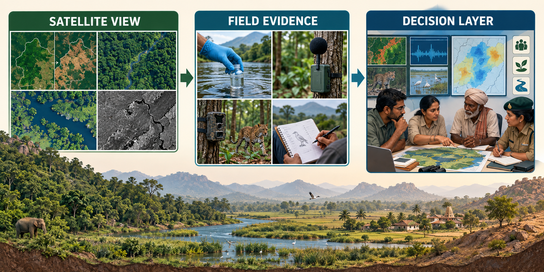
A layered model for biodiversity intelligence decisions
Organizations can build a useful system in five layers.
1. Map the decision boundary
Start by defining the decision. Are you screening a loan portfolio, monitoring a mine, checking agricultural suppliers, or measuring restoration?
Then map the relevant facilities, suppliers, project sites, catchments, and ecosystems. Poor location data will weaken every later layer.
2. Use satellites for broad screening
Apply Earth observation to find visible change across the full area. This stage should prioritize sites for attention. It cannot measure biodiversity completely.
For example, a model may flag forest clearance near a supplier location. It should not automatically label the supplier responsible.
3. Add species and ecosystem evidence
Use eDNA, acoustic sensors, field surveys, camera traps, or other suitable methods at high-priority sites. The right mix depends on the ecosystem and the question.
A river assessment may rely more on water samples. By contrast, a forest project may combine acoustic sensors with vegetation plots and satellite change detection.
4. Let AI connect the evidence
AI can combine time series, classify images, detect anomalies, and summarize large datasets. It can also help link environmental signals to assets and supply chains.
However, the system should preserve the source behind every conclusion. A manager must be able to distinguish an observed change from a model estimate or an unverified alert.
5. Assign human accountability
Someone must own the final decision. The model should not decide whether a project proceeds, a borrower loses finance, or a community faces restrictions.
Instead, leaders should define escalation rules, verification steps, appeal routes, and review dates. This is especially important when biodiversity data affects livelihoods, land access, or credit.
Where Indian organizations can begin with biodiversity intelligence
Most organizations do not need an advanced autonomous system on day one. A disciplined pilot can create more value than a broad platform with weak data.
Begin with one decision and one landscape. For example, a bank could screen agricultural borrowers in a water-stressed basin. A manufacturer could monitor habitat change around its largest operating sites. A food company could examine deforestation exposure within one commodity chain.
Next, record four things:
- which environmental change the system must detect;
- which data source can observe it;
- what the technology cannot establish; and
- who verifies the alert and decides what happens next.
This approach also helps prevent a common mistake: treating better disclosure as proof of better environmental performance. A polished dashboard may improve visibility while the underlying ecological condition continues to decline.
Therefore, the organization must connect each metric to an outcome. Forest cover, species presence, water quality, habitat connectivity, and restoration survival answer different questions. They should not be collapsed into one convenient score without a clear scientific basis.
The next frontier is continuous, not automatic
Biodiversity intelligence is moving from occasional studies toward continuous monitoring. That shift can give businesses, investors, regulators, and communities earlier warning of environmental change.
Continuous monitoring still requires human judgment. Satellite systems are strongest at broad observation, while ground methods add biological detail. Local knowledge supplies context that either source may miss. The evidence then needs a named decision owner who can weigh uncertainty, consider the people affected, and decide which action is justified and fair.
The winning system will not be the one with the most AI. It will be the one that joins independent observation, field validation, transparent uncertainty, and accountable decisions.
Explore GreenCentral’s Earth Observation analysis and its wider Nature & AgriTech coverage for related climate and natural-systems decisions. For governance questions, read the practical guide to AI governance for climate action.